
Maps are about more than just space
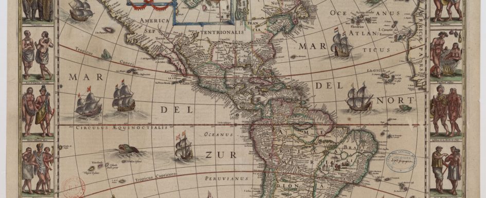
At first glance, the map may not look like a data-dependent project. But with Matthew Edney’s guidance, the data of cartography became clear at the inaugural Friday lunch seminar in Information Ecosystems: Creating Data (and Absence) From the Quantitative to the Digital Age. Edney, the Osher Professor in the History of Geography at the University of Cartography at the University of Southern Maine, does, however, work with data. Maps, Edney’s specialty, require a lot of data, as it turns out. And the appearance of the finished map depends on what data is collected, for whom, and why. As Johanna Drucker has reminded us, the information scholars work with isn’t given as much as taken, hence her alternate term for “data” – “capta.” That concept is clear in Edney’s work, and in the lively discussion that took place during the Sept. 6 seminar, which included Edney and more than twenty Sawyer Seminar participants from the University of Pittsburgh and Carnegie-Mellon University. Edney’s 1997 book, Mapping an Empire: The Geographical Construction of British India, 1765-1843, argues that the British did not record the geographical boundaries of India so much as they invented the space called India to fulfill their imperial ambitions. His new book, Cartography: The Ideal and Its History, puts into tension the ideal of a map – that it is a completely accurate, objective representation of geography – with its reality – that it is in fact a representation of Drucker-esque capta, with all the subjective decisions that go along with amassing that capta. That’s a Read More